Whether you’re seeking out old coins, relics, or evidence of human occupation, understanding the tools and techniques available for property research can greatly enhance your quest for high-yield permissions. From historic aerial imagery to old survey maps, each resource offers a unique perspective – when combined, offers helpful decision making information. In this article, we’ll explore a variety of tools and how to effectively utilize them in your historical research endeavors.
1. Historic Aerial Imagery
One of the most valuable resources for uncovering the secrets of the past is historic aerial imagery. Websites like HistoricAerials.com and VintageAerial.com provide access to a vast archive of aerial photographs dating back several decades. By comparing these images to modern-day satellite imagery, you can identify changes in the landscape over time, including the presence of old structures, roads, and land use patterns.
To use historic aerial imagery effectively, focus on areas of interest and look for anomalies such as square depressions or linear features that may indicate the presence of old foundations or roadways. Pay attention to changes in vegetation density, as these can also provide clues to past land use.
2. Topographic Maps and Hillshade Analysis
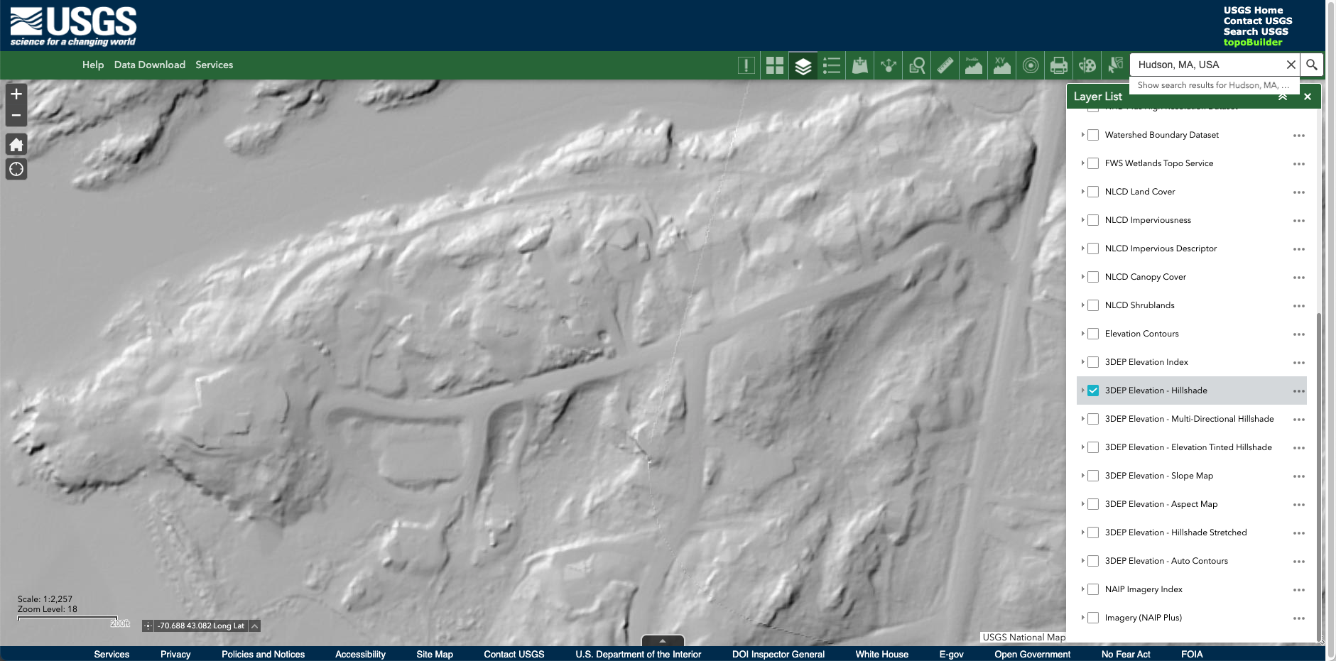
Another valuable tool for property research is the use of topographic maps and hillshade analysis. Websites like the USGS Viewer and EarthExplorer provide access to detailed topographic maps and imagery, allowing you to visualize the terrain without vegetation cover.
To utilize this tool effectively, look for features such as old foundations or earthworks that may be visible as shadows or depressions in the landscape. Hillshade analysis (seen in the photo above) can help highlight these features by simulating the effect of sunlight on the terrain, making it easier to spot subtle changes in elevation.
3. Sanborn Maps and Survey Maps
For those seeking detailed information about past structures and land use, Sanborn Maps are indispensable resources. Sanborn Maps, created for fire insurance purposes, provide detailed depictions of urban areas, including building footprints, materials, and street layouts. Survey maps, on the other hand, often mark structures with symbols indicating their type and material. Further, historic topographical maps can also be found on USGS.
Use these maps to identify the locations of old buildings, roads, and property boundaries, providing valuable context for your research.
If you’re visiting us for the first time, don’t forget to sign up for the Bucketlister newsletter! We publish weekly, covering the most desirable metal detecting finds.
4. GIS Data and LIDAR Mapping
In addition to aerial imagery and maps, Geographic Information Systems (GIS) data and LIDAR mapping offer powerful tools for property research. GIS data layers, available through county or state agencies, provide detailed information about land use, parcel boundaries, and historical features. LIDAR mapping, which uses laser technology to create highly detailed 3D models of the terrain, can reveal hidden features such as old foundations and earthworks beneath tree cover.
To access GIS data and LIDAR maps, contact your local county or state GIS department, or explore online portals such as EarthExplorer and state-specific GIS websites. Use these tools to overlay different data layers and analyze the landscape from multiple perspectives, uncovering hidden clues to the past.
Conclusion
In the quest to uncover good metal detecting locations, historical research tools play a crucial role. Each tool noted above can provide valuable insights into past land use, settlement patterns, and old homesites or foundations.
Good luck out there and sign up for the newsletter (above) to get tips like these and information on bucketlisters, delivered weekly to your inbox.
Member updates/additions:

